This website is better experienced on desktop.
Please visit this page again from a PC or visit our homepage at eiland.design

See you there!

Chasing Eilands:  

Reviving the cultural heritage landscape
of Kortrijk’s Moated Homesteads
through an open source database

Elena Falomo
Emilie Froelich
Jadd Hallaj
The moated homesteads of Kortrijk are vernacular settlements that are surrounded by a moat, hidden within the urban sprawl of the city. In Late Medieval times they constituted a network which stretched from the urban centers to the countryside across the whole region, following the watersheds.
Nowadays, a lot of these spaces have transformed into social catalysts with different vocations: educational, recreational, cultural, environmental... We believe in the value of this network as a cultural heritage and in its future potential to promote new forms of sociality and human-nature symbiosis.
From above, these moated farmsteads look like islands, or in dutch: “eilanden”… What can their story teach us? How can they help us reorient our vision of urban life and project us into a sustainable future?

De Wildernis

Our research started by the discovery of a particular space, an “Adventure Construction Playgroundnear the center of the city. The water surrounding the park was ideal to immerse the children in their own world. The parents are not allowed to enter the island, and must stay on the mainland. 

We were told that before this part of the park was taken over by this inspiring initiative, it was actually a moated farm. Intrigued, we researched into historic references to see what it would have looked like. That was where we discovered that this typology was a recurring event throughout the territory.
Gebroeders Van Raemdonckpark in 2020.
Gebroeders Van Raemdonckpark in 1959.
The Drei Hofstätten: Three moated farms that preceded the Gebroeders Van Raemdonckpark. The area surrounding the park, is still nowadays called "Drie Hofsteden" of "Three Farms".

By cross referencing this 1870 Popp map on the remainder of the territory, we can see that this typology is a recurring event.
[See image below]
Each island is unique in its configuration

We used a compilation of a set of historical georeferenced maps of the region we had previously put together, dating back as far as the 1600s, to investigate the evolution and the recurrence of this spatial typology.

… it turned out to be a forgotten treasure of the region’s landscape!  
1600
1646
1712
1712
1745
1750
1826
1900
1841
1850
1875
1900
1950
1971
2018
1950
1950

Process

Architectural Research 

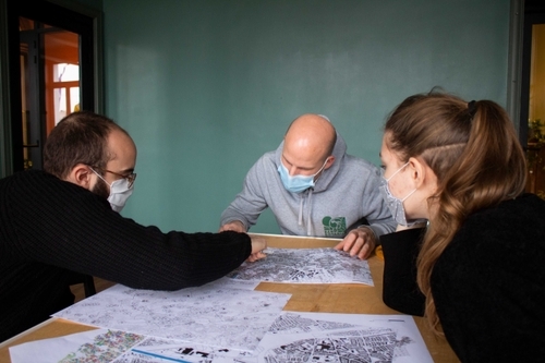
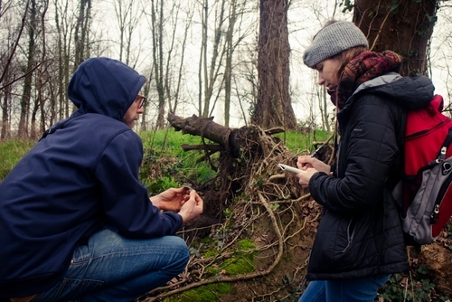
To document these spaces we have used a mixed technique approach. We have carried anthropological research through surveys and interviews, to understand the cultural and social values connected to the moated farmstead, along with investigating their historical heritage. This has been complemented through architectural and urban surveying to highlight the uniqueness of the moated farmsteads’ composing elements, and to understand the link between the conformation of the territory and the birth of this architectural typology.

Digital Documentation

We have enriched the traditional documentation through digital assets such as drone footage, 3D scans and photos. All the digital assets, along with historical documents are being published in an open-source database. We also combined a Geographic Information System analysis with data science, to study the intersection of social and geographical factors across Flanders and beyond.

Engagement

Our research process is instrumental to valorizing this local heritage and integrating it into a sustainable longlasting territorial vision and management. Different publications, workshops, exhibitions and educational collaborations that we are enterprising aim at transforming the dataset into living and concrete territorial interventions.

What is an eiland?

The spaces of these moated farmsteads are defined by several elements which can be composed and modified to create different spatial and symbolic configurations.The resulting morphology is a self-sustaining ecosystem derived from centuries of evolution in traditional knowledge preserving flora and fauna. These designed landscapes offer lessons in natural resources management and conservation.

Water

The moat is the central element that defines these spaces. Each moat is connected to a main waterway, linking each farm to a water network which extends across the countryside. They function as water reservoirs and as drinking basins for animals, to defend the farm and to show the social status of the family.

Bridge

The bridge is often the only pathway to access the inner land. It is flat to be accessible by the farm animals [cattle, horses, pigs], humans and vehicles at the same time. In this regard, they used to be quite wide; they are often covered by the “poorte”.

Poorte

Sometimes painted in a bright color , it constitutes the monumental entrance to the farm. . The appearance of the poorte, often gave the name to the farm. They are still very influential toponomastic elements with streets, city quarters, businesses, etc... being named after them. Frequently they present a niche with a representation of the Virgin Mary.

Buildings

They are mostly arranged in a U or semi-circular shape, defining a wide courtyard around which the farming activities revolve. The buildings that can be found are usually a living block, a workshop and material storage space, and stables or animal shelters.

Trees

Trees have multiple functions. They can be placed on two parallel rows to frame the path that leads to the eiland. When they are placed in a circle around the moat they provide shade, sound and visual isolation. Many eilands present a “main” tree in the center of the inner land. They are the perfect habitat to host a variety of endemic bird species

Chapel

Dispersed across the countryside, between one eiland and another, or along the entry path of an eiland we can find a chapel or a wayside shrine. These small chapels host a depiction of a saint or a Madonna. They show the religious devotion of the homestead owners and they offer a moment of religious worship to wayfarers. 

The Database

The database is indexed in this map. We classified the eilands according to the state of conservation of their moat, so as to understand the level of preservation of this heritage, and its vulnerability facing the urban development of the city.

Intact Moat

Eroded Moat

Disappeared Moat

Area of Study

Data visualizations.
We explored different means of representing the data with installations and physical data visualizations which were exhibited in local galleries and festivals.  Here, each string represents an island, and the color indicates the state of preservation of the moat (as indicated on the database map above).

Stories of Data Analysis

This spread-out individual farming system seems to be a particularity for the west Flemish region and is translated through particular spatial, social and economic practices in the countryside.

Land tenure

These Eilands are linked to the ancient Flemish land tenure systems, belonging to a hierarchy of social allegiances and land ownership. This is linked to the individual farming systems where each isolated farm manages the land surrounding it, and shares few spaces with adjacent farm lands.

This explains hos the region developed a specific structure in its countryside, that differs from other regions where collective farming is more common.

A dense network

The average mean distance between each sample is about 500 m, and reflects the hierarchy of the medieval power structure. It’s thus a dense network spreading from the city center to the countryside. This offers many development opportunities for a sustainable city.
Scattered around the territory, these spaces offer different historic and contemporary  interpretations. 

Ecosystem

The eilands offer a very rich ecosystem for the development of local biodiversity.
The surface of the moat’s water is usually half the surface of the inland,
so as to protect the farm or house from the abundant water of the surrounding wetlands.
Traditional construction techniques limit the absorption of the water in the earth so
as to preserve it for use during summer. Local land management also has developed
methods for the maintenance of fauna and flora.  

Late 1900s

2021

The Eilands offer particular spatial, social, and ecological particularities, that can be developed and be anchored in contemporary spatial practices.


Regional Scale

We decided to try and determine if the Eilands are a specificity of the region or not.
So we used blob recognition and image processing to isolate built up areas in all of Northern Europe.
This made different rural territorial structures apparent in the countryside.
We see that Flanders is really characterized by a dense network of spread out
small built up areas, whereas Wallonia and Northern France are characterized
by concentrated big built up entities (villages and cities).
We can see that these moated farmsteads are anchored in a local tradition of urban sprawl.
It is yet to be determined whether this is unique to West Flanders. 

Eiland(s) Atlas

We have also produced a complement to the database: an Atlas of the moated farmsteads. Easily consultable through this link, it provides maps and accessible geographical information to the public.
Download the Atlas